You are hereGallup - What to Do
Gallup - What to Do
| Pilot Getaways - Gallup, NM | |
What to Do |
|

 We had come to Gallup for a very special aviation adventure. Karl, a local balloon pilot, had offered to take us up the face of Red Rock in his balloon, Yei Gallup. Though it seemed like perfect flying weather to us, we quickly learned that different kinds of pilots use different criteria for judging the weather. Balloons cannot tolerate much wind and all of our days in Gallup were too windy.
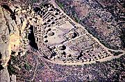
Since ballooning was out of the question, Karl suggested we join some local pilots in the West End Cafe for their daily morning coffee ritual. They provided a wealth of information about airstrips and sights throughout the region. We heard about Canyon de Chelly, Chaco Canyon, Hubbell Trading Post, and a multitude of other destinations, many of which are only served by dirt strips.
Not having brought a lot of emergency equipment, we were not going to leave the vicinity of paved roads. This ruled out the more exotic destinations, such as Chaco Canyon and Canyon de Chelly. Both destinations would have offered the stunning scenery of deep canyons and rugged terrain. Instead, we chose Hubbell Trading Post, one of the original sites on Navajo land. We would be able to fly into the local dirt strip in Ganado (85V) and would never be far from a road. A local pilot cautioned, "Drag the field before you land. In this part of the world, animals roam freely and sometimes you'll find them on runways." Another local named Bob added: "You shouldn't just depart from Gallup airport and go straight towards Ganado. First, take a look at the canyons just west of the airport. Nothing special, mind you, just beautiful. You need to start there. It's a good introduction to sightseeing around here."

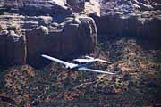
 Shortly thereafter, we were flying alongside Bob's plane. He had volunteered to guide us to the canyons west of town and get us on our way to Ganado. In this way, we were treated to two great sights - the beautiful canyons and Bob's pristine Comanche, on which he had spent many hours polishing the aluminum finish. After Bob rocked his wings and returned to Gallup, we continued along Highway 264 to our destination.
When we arrived at Ganado, we carefully dragged the strip, making a low pass along the side of the runway to check runway conditions. The strip looked good, but there was no windsock! Time to borrow from the world of seaplanes. Seaplane pilots often inspect lakes and islands for glassy bands of water where the water is sheltered from the wind by the shoreline, indicating that the wind is blowing from that direction. I could see calm water along the northern shoreline of a nearby lake and on the south side of a small island. "Okay," I announced, "We land to the north." No sooner had I uttered these words when Andreas shattered my aviator's pride by pointing out a small windmill. Its weather vane was clearly visible and it far more obviously confirmed that the wind was, indeed, out of the north.
After an uneventful landing, we taxied to a small tiedown area on the west side of the runway, tied down the airplane (bring your own equipment!), and began the "short," 1-hour walk to Hubbell Trading Post. This walk gave us much opportunity to reflect upon the advantages of prior research and making advance arrangements for ground transportation.
First, we visited the Park Services Office. Although we had talked to local pilots before we set out, it would have been much smarter to have talked to someone at Park Service or the Trading Post first. They can be reached for an update on runway conditions and can arrange a more convenient mode of ground transportation. The Park Service's phone number is (520) 755-3475 and the Trading Post's is (520) 755-3254. Both are open 8 a.m.-5 p.m., 7 days a week. If the runway is unusable, Hubbell Trading Post is no more than 60 miles from Gallup and can easily be reached by car via Highway 264.
Hubbell Trading Post was founded in 1878 and served as a general store. Years ago, Navajo jewelry, blankets, rugs, and pottery were the denomination that bought food and supplies for the Native American population. Although it has grown into a shop for visitors, a general store where you can find everything for daily life remains. This historic site provides a meaningful illustration of how Native Indians succeed in preserving their cultural tradition while turning Indian artwork into a viable economic base for the Navajo Nation.
We could have spent hours looking around and listening to local stories, but we did not want to miss the Park Service's offer of a ride back to the airport. Back at the dirt strip, we noticed a Cessna having a very difficult time gaining altitude. I quickly re-examined my calculation for runway requirements at a density altitude of 8,500 ft., but found everything to be okay. 85V provides more than twice the runway length required in the handbook. Throwing up sand to check wind direction (remember: no windsock) revealed the answer to the puzzle posed by the Cessna's poor performance: the wind was still blowing out of the north and the Cessna had taken off with a tailwind. We elected not to follow that example and were rewarded with a healthy climb out to the north. On the way back to Gallup, we circled Window Rock, a city about 25 miles to the NW of Gallup, which is named after its landmark "window" (hole) in a rock formation. We also noted that the runway there is paved. The rock formation and the adjacent Navajo Nation Headquarters and Navajo Tribal Museum are within walking distance of the airport. Self guided tours, (520) 871 6675.
Both destinations are easily accessible by car. You can obtain plenty of advice for similar trips at the Gallup Convention and Visitors Bureau, which has its offices in the restored old train station on the north side of Main Street, (505) 863-3841 or (800) 242 4282.
Red Rock State Park, just a few miles east of town, makes a great day trip. There may even be a balloon or two launching in the early morning. If the weather is right and you want to fly in a balloon, make arrangements through Karl Lohmann, (505) 722-6274. Not surprisingly, this park is where the Red Rock Museum can be found. Open 8 a.m.- 4:30 p.m., closed on Sundays, (505) 863 1337. The museum provides an overview of the Native American cultures in the region and explains their crafts and artwork. Many events are held at Red Rock State Park each year, the two most notable being the Intertribal Indian Ceremonial in August and the Red Rock Balloon Rally in December.
In downtown Gallup, shopping for Native American artifacts is paramount. All you have to do to get started is to walk along Main Street/Historic Route 66. There are said to be more than a hundred trading posts in the area and you can easily spend all your time (not to mention travel funds) shopping.

 On the return trip, we had the pleasure of viewing some unique flightseeing areas in the vicinity. The El Malpais National Monument and National Conservation Area Lava Fields are situated south of Interstate 40, about 60 miles southeast of Gallup. These lava fields extend for about 30 miles south-southwest of the Interstate and provide a fascinating geological sight from the air. The east side of the lava fields was more scenic; however, we avoided flying directly across the center of the fields. The terrain there is so jagged that an emergency landing would be next to impossible. Fortunately, roads on the east and west sides of the lava fields provide safe emergency landing sites if you fly along the periphery of the fields.
Another 10 miles east of the lava fields along I-40 and 10 miles south, is the Acoma Pueblo and Mission. Believed to have been founded around 1150 A.D., it is the oldest continuously inhabited Indian pueblo in North America. Also called "Sky City," the Acoma Pueblo sits on top of a mesa, more than 300 feet above the valley floor. When illuminated by sunshine, the white adobe structures stand out starkly against the backdrop of the desert floor.
Unfortunately, neither the El Malpais Lava Fields nor the Acoma Pueblo are served by airports, so they are good candidates for travel by car. Acoma Pueblo can be reached by going east on I40 to exit 102, then south for about 15 minutes. Detailed information about walking, guided tours can be obtained by calling (800) 747-0181. El Malpais is closer, just go to exit 89 on I40, then go south to the ranger station on Highway 117. For more information, call the Park Service Information Center at (505) 783 4774. Open 8:30 a.m. to 4:30 p.m.
If you do tour by car, make sure to visit the Bandera Volcano and the Ice Cave, a collapsed lava tube where the inside is cold enough to preserve ice. Take exit 81 off I-40, then follow Highway 53 25 miles southwest. Follow the signs to the Ice Cave. Open 8 a.m. to one hour before sunset, year-round. (888) 423 2283.
=> where to stay
Feature Article: Gallup, NM, by Gerhard Deffner

Page 1 ............... Main Page / Intro
Back to Pilot Getaways Home Page
Page 2 ............... Flying There
Page 3 ............... History
Page 5 ............... Where to Stay
Page 6 ............... Where to Eat
Page 7 ............... Transportation

